

A map is a claim. "The West corporation has the smallest share of park and lake area" is a claim, and a careful reader wants to know where it comes from. A few lines at the foot of the page answer that, and they are what separate a map you can trust from a picture.
What goes in a credits block?
A credits block, sometimes called the source note, is the small text at the bottom of a layout. It usually has:
- the name of each data provider
- the date of the data, and the date of the analysis if different
- a short description of the method
- the projection, when it matters for interpretation
- the licence or attribution the data requires
- who made the map
Why it matters
A source note lets a reader judge how current the data is. It lets a colleague repeat the work. It protects you, because it records what was actually done. And many datasets require attribution as a condition of use. OpenStreetMap, for example, is licensed under the Open Database License (ODbL), and its users must credit "OpenStreetMap contributors".
The rules
- Name each source, with the provider and the year or date.
- Keep dates apart. The date the data was captured, the date it was downloaded, and the date the map was made are three different things. Say which one you are giving.
- Describe the method in one or two sentences, especially thresholds, classification methods or exclusions that change what the map shows.
- Do not present a derived class as if it were measured on the ground, unless someone has checked it.
- Add a short limitations note when gaps in the data or in its quality could change a reader's conclusion.
- Check the licence and attribution wording of every third-party dataset you use.
- Keep it short and specific. Two or three lines in a small, readable size are better than a paragraph nobody reads.
An example
The map used in this series carries this note:
Data: OpenStreetMap contributors (ODbL), downloaded 8 October 2026; city corporation boundaries from OpenStreetMap, 13 October 2026. Method: area of parks and lakes inside each corporation divided by its area, calculated in EPSG:32643 (UTM zone 43N). Map: Time & Spatial.
It names the source and the licence, gives two dates, states the method in a sentence, names the CRS and names the maker. One limit is missing from the page and belongs in a longer report. The shares depend on how completely volunteers have mapped parks and lakes in OpenStreetMap, so a corporation with more complete mapping can look greener than it is.
See the difference
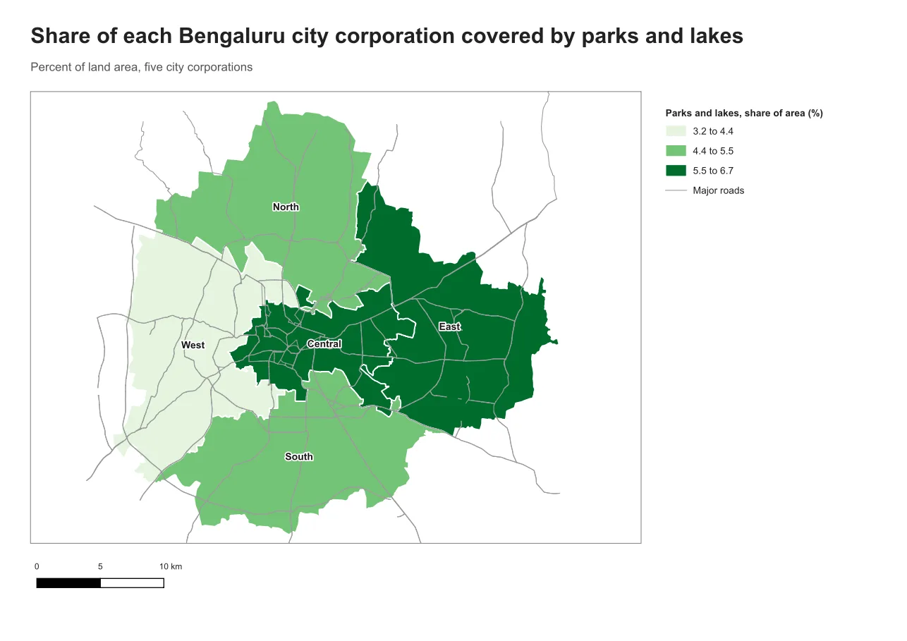
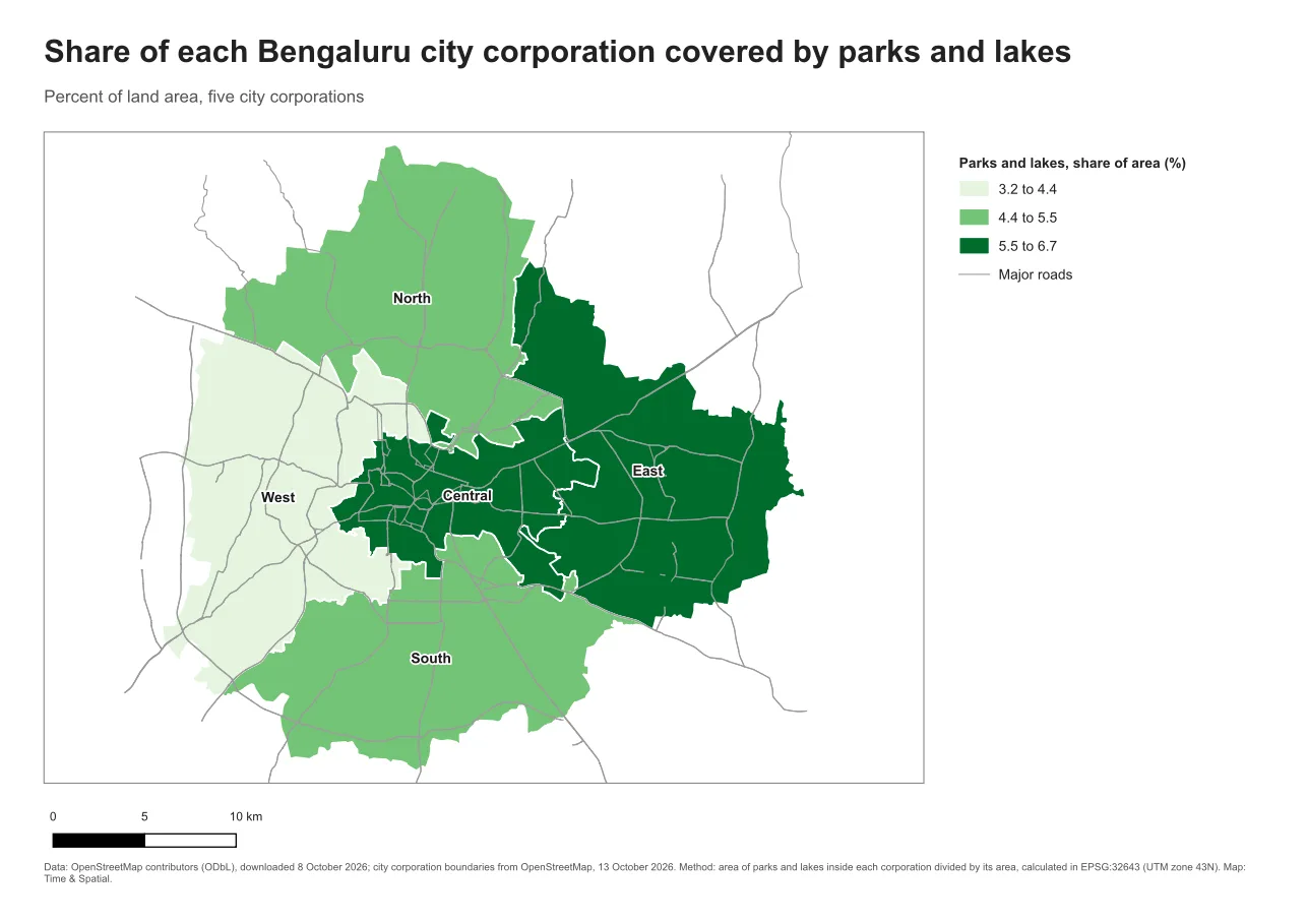
Do it in QGIS
- Add a label with Add Item > Add Label and write the credits block.
- Set a small, readable size, 6 to 7 pt on A4, and a soft grey. Keep it inside the margins.
- For text that changes between maps, such as a date, use an expression inside the label. Write
[% format_date(now(), 'd MMMM yyyy') %]to show today's date. Part C of this series uses expressions to fill labels automatically. - Check the final export. The note must not be clipped or hidden behind another item.
Common mistake: no source note at all
A map without sources looks finished, and that is the danger. The fix is to make the note part of the template, so that no map leaves without one. A second mistake is a note that says only "Source: internet". Name the provider and the date.
Glossary
| Term | Meaning |
|---|---|
| Attribution | The credit that a licence requires you to give to the data's creators |
| ODbL | The Open Database License, used by OpenStreetMap |
| Method note | A short description of how the numbers were produced |
| Limitation | A known weakness in the data or method that readers should know about |
Practise it
Add a credits block to one of your maps with five items: provider, data date, method, projection and author. Then ask someone who did not make the map whether they could repeat it from your note. The Print layouts in QGIS tutorial includes a credits step.
Test yourself
1. Why separate the date of the data from the date of the map?
Readers judge how current the information is from the data date. The map date only says when it was made.
2. What attribution does OpenStreetMap data need?
A credit to "OpenStreetMap contributors", under the Open Database License (ODbL).
3. Why mention a limitation on a map?
If gaps or quality problems could change the reader's conclusion, they need to know, so that they do not trust the map more than it deserves.